


Quang Nam Province

10406 km2

Southern Central Coast

10

11730

1,505,000 people (2015)
 Geography
 Economy
 Connection
 Infrastructure
 Government
 Social - Culture
| Total Area | 10406km2 |
| Agricultural Production Land | 1156 km2 |
| Forestry Land | 7266 km2 |
| Specially Used Land | 368 km2 |
| Residential Land | 215 km2 |
|
125 km |
|
| Borders |
The northern border province of Thua Thien - Hue and Da Nang city, Quang Ngai province on the south and Kon Tum province, with the provinces of Sekong (People's Democratic Republic of Laos), the east China Sea |
|
Climate
Tropical monsoon with 2 distinct seasons: the rainy season, August to December, the dry season, January to July. Average annual temperature: 250C. Average annual precipitation: 2,000 – 2,500mm. Average air humidity: 84% Topography: relatively complex, sloping gradually from west to east forming 3 ecological regions: the mountain- ous, the midland, the plain and coastal regions. On the other hand, the land is partitioned by Vu Gia, Thu Bon. Tam Ky rivers flowing through, forming sub-regions with particular features. |
|
|
Natural Resources
Land and forest: mostly forest land, mounts and hills, and some plant cropping, fish farming land suitable for agro– forestry – fishery development. Annual plants grow mainly along Vu Gia, Thu Bon rivers and in the southern plain water fed by Phu Ninh Lake. The western mounts and hills would be propitious to perennial crops and raw material plants, raw material supply forests and animal husbandry. Forest land with its resources holds high potential and bio-diversity reserves. Natural forest timber reserves amount to nearly 30 million m3, 50 million bamboo stumps, and other plants (rattan, palms). Noteworthily, Tra My cinnamon, Ngoc Long ginseng have become renown products of Quang Nam. Actually there are 2 natural forest enclaves, 60 scenic sites, pretty ponds, creeks, riverine islets (Phu Ninh, Thuan Tinh lakes). Water resource combined with hydropower plants: Quang Nam river-rivuler network is fairly densely knit. A Vuong, Kon, Cai, Tranh rivers blend in confluence to make up Vu Gia river regime. An immense water resource is created by Vu Gia – Thu Bon rivers whose catchment area down to Hoi An estuary accounts for 10,400km2. Their hydro power-potential is valuated at 5 billion kWh/year, ranking the 4th biggest nation wide. The hydro-power plant system Vu Gia – Thu Bon on a staircase gradation is under construction planning concurrently with over 30 medium-small scale hydropower plants already planned for construction investment up to the year 2015. Sea: Quang Nam coast line stretches over 125km from Dien Ngoc (adjacent to Danang) to Dung Quat Bay. To thenorth it meets Cua Dai (Hoi An) estuary, to the south, An Hoa estuary. Truong Giang River running along the coast, connects the 2 estuaries. Pier No 2 at Ky Ha Port has been built and made operational, contributing to Chu Lai Economic Zone development investment attraction. Quang Nam has insular villages of Tan Hiep, Cu Lao Cham appurtenant to Nui Thanh – Chu Lai. It has several estuaries, canals totaling 30,000ha water surface (inclusive of fresh, semi-saline, saline water), of which tidal beds cover 10,000ha. This water surface lends itself well to fish farming. The fishing ground covers 40km2, fish reserve amounts to nearly 40,000tons, annual allowable exploitation ranges from 42 to 45 thousand tons, 30% of which could be processed for export. Quang Nam sea abounds in prized marine animals: holothuria, abalone, lobster and particularly swallow nests in Cu Lao Cham islet. Minerals: Mineral resources are fairly abundant. More than 200 deposits and mines have been discovered and appraised with more than 35 minerals, namely iron, manganese copper, lead, zinc, tin, gold, titanium. Non metallic minerals include limestone, cement, clay, feldspar, construction stone, construction sand, peat, glass making sand, kaolin for porcelain, ceramic ware making, mineral water. With abundant mineral resources, Quang Nam holds potential to develop industries which it has an edge on such as mineral exploitation and processing, construction material fabrication. |
|
| GDP Growth Rate | 7.4% (2015) |
| Population | 1,505,000 people (2015) |
| Population Density | 142 person/km2 (2015) |
| Population By Sex | 95.7 males per 100 females (2015) |
9.20% (2015) |
|
| Immigration Rate | 2.50% (2015) |
| Labor Force At 15 Years Of Age And Above | 58.30% (2015) |
| Unemployment Rate | 4% |
|
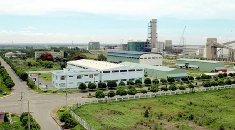
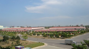
Major Industries
Manufacturing and processing industry; manufacturing, food processing; automobile manufacturing, electronic chips, ceramic tiles,... |
|
| Annual Average Capital Of Enterprises | 59,392 billion dongs (2014) |
| Net Turnover | 91,372 billion dongs (2014) |
| Profit Before Taxes | 4,227 billion dongs (2014) |
| Profit Ratio | 4.58% (2014) |
| PCI | 61.06 (2015) - Rank: 8 |
Total Area: 50m2
Occupancy Rate: 100%%
Address: Dien Thang Commune, Dien Ban District, Quang Nam Province.
Total Area: 0m2
Occupancy Rate: %
Address: Duy Xuyen District, Quang Nam Province.
Total Area: 120m2
Occupancy Rate: 0%
Address: Binh Phuc, Thang Binh, Quang Nam
Total Area: 211.26m2
Occupancy Rate: 8%
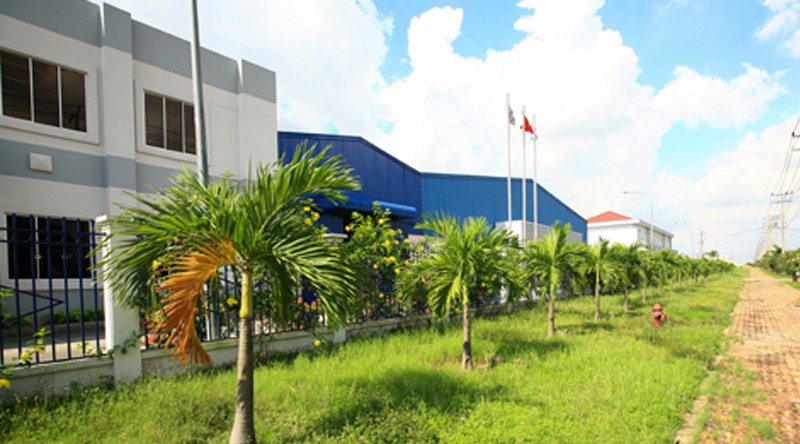
Address: Huong An, Que Son, Quang Nam
Total Area: 418m2
Occupancy Rate: 0%
Address: Dien Nam Bac, Dien Ban District, Quang Nam Province.
Total Area: 106.29m2
Occupancy Rate: 0%
Address: Quang Phu, Quang Ngai city, Quang Ngai
Total Area: 211.26m2
Occupancy Rate: 0%
Address: Huong An, Quang Nam, Vietnam
Total Area: 0m2
Occupancy Rate: 0%
Address: Quang Nam Province, Vietnam
|
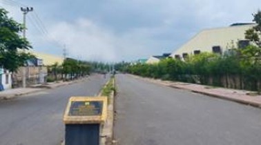
Transportation
Roadways: Total land communication roadway in Quang Nam extends to 6,217km. Five national roads cross the province: Ho Chi Minh Roads 1A, 14B, 14D, 14E totaling 470km. There are 18 provincial roads totaling 420.9km, 179 district roads, intra-municipal roads totaling 1,150.5km. Village and inter-village roads cover 4,230km. There remain 29 villages lacking automobile passable roads to the village center, totaling a length of 306km. Waterways: Ky Ha Port sitting in Chu Lai Economic Zone, adjacent to Dung Quat Economic Zone (Quang Ngai Province) includes 3 component parts: Tam Quang, Tam Giang linked to customs free area, Tam Hiep cluster linked to Tam Hiep Industrial Park. From Ky Ha Port, goods shipment to other countries can be easily effected. Ky Ha Port is also a good transit point to international maritime routes. Eleven main rivers in Quang Nam cover a distance of 941km, of which 307km (or 32.62%) is in serviceable. There are 2 rivers in service operation, Truong Giang and Thu Bon, both flow out to the East Sea through 3 estuaries: Song Han, Cua Dai and Ky Ha. Serviceable riverine water transport extends to 207km covering 11 routes. Airways: Chu Lai Airfield, one of the 6 major airports of Vietnam, avails a land space of 3,000ha. It can handle a maximum 100-ton freight per flight, an average annual of 2.55-million foreign passenger load, and 1.55-million local passenger load. Nevertheless, because of recent operation, air travel has not gained common currency, the airport runs at 50% under capacity, offering only twice-weekly Chu Lai – Ho Chi Minh City flights. Chu Lai Airfield has been planned to become an international transit airport. Railway: the national railway cuts through Quang Nam Province over a distance of 95km, making stop-overs at Tam Ky, Diem Pho, Nui Thanh stations. |
|
|
Telecommunications
Fixed line telephone subscribers by the first 6 month of 2012 was 958.873. Average telephone density: 66.48/100 people. Telecom, internet services grew quite rapidly. 2012 internet users rating was 10.95/100 people. |
| People's Council | 62 Hung Vuong Street, Tam Ky City, Quang Nam Province. |
| People's Committee | 62 Hung Vuong Street, Tam Ky City, Quang Nam Province. |
| Relevant Government Departments |
|
| Province | Quang Nam Province |
| Headquarter of People's Committee | 62 Hung Vuong Street, Tam Ky City, Quang Nam Province. |
| Official Provincial (or City) Website | www.quangnam.gov.vn |


