


Long An Province

4495 km2

Mekong River Delta

37

15085

1,469,900 people (2013)

3
 Geography
 Economy
 Connection
 Infrastructure
 Government
 Social - Culture
| Total Area | 4495km2 |
| Agricultural Production Land | 3133 km2 |
| Forestry Land | 388 km2 |
| Specially Used Land | 445 km2 |
| Residential Land | 249 km2 |
| Borders |
Side adjacent to Ho Chi Minh City and Tay Ninh Province, north to Svay Rieng province, Kingdom of Cambodia, the west with the southern provinces of Dong Thap and Tien Giang provinces bordering. |
|
Climate
Long An is in the humid tropical monsoon area. Being adjacent to the southeast and southwest regions, the provincial weather shares several specific characteristics of the Mekong Delta and the southeast region. The monthly average temperature is 27.2-27.7oC, increasing to the highest of 28.9oC in April and decreasing to the lowest of 25.2oC in January. The temperature amplitude among months varies from 2 – 4oC. The average humidity is 79-82% and the total suny hour is 2,718 a year. These are idealistic conditions for year-round cultivation. The annual rainfall varies from 1,447 – 1,886 mm, dividing into 2 distinct seasons: the dry season lasts from November to April, which is accompanied by the northeast wind with frequency of 60-70%, and the rainy season from May to October with the southwest wind, with a frequency of 70%. The rain during rainy season accounts for total 70 - 82% of the yearly rainfall. Rains distribute irregularly, decreasing from the area bordering HCMC to the west and southwest. Coastal districts in the southeast have lesser rainfall. High intensity of rains causes erosion in hilly areas and flooding when they combine with high tides, affecting the people’s production and living. Wind regime: the northeast wind blows during the dry season from November to April with a frequency of 60-70%, the southwest wind blowing from the during the rainy season from May to October with a frequency of 70%, bring much vapour and causing much rain. |
|
|
Natural Resources
Land resources: The soil is comprised of 6 main types: gray soil, ancient siltation accounts for 21.5% of total area, sweet siltation soil accounting for 17% of total area, saline siltation soil 1.26%, acid sulfate soil: 55.47%, saline acid sulfate soil: 3.9%, peat soil: 0.05%. Mainly sediment deposition mixed with many organic impurities, having a friable texture and poor physico-mechanical properties. Many areas are affected by acidic alum and accumulated toxin. Majority of land in Long An has been developed from silt mixed with organic impurities, creating soft and porous soil. In low area, there is an accumulation of toxic harmful substances such as Cu, Pb, Cd, etc. in acceptable limitation, creating acidic and alum soil. This is a typical feature of the Mekong Delta where land is infected by acidity and alum, which is not suitable for agriculture development. Total alum area is 208,449 ha, accounting for 69,8 % of the area of Dong Thap Muoi and 46,41 % of the provincial area. At present, there remain 2 low regions - center of alum in Bac Dong and Bo Bo - Mo Vet. There are three main land types: agricultural land, non-agricultural land, and unused land. The former still accounts for 81% of the provincial land until 2010. The non-agricultural land accounts for 19%, of which 5% is for residential area. The agricultural land is mainly for paddy cultivation. However, it has been transferred to urban area for many utilization purposes recently. The aquaculture land concentrates mainly along big rivers and their estuaries. The total area is 43,999 ha, decreasing 6,893 ha as of 2005. Only Tan An City and two districts of Tan Tru and Chau Thanh where there are no forestry land. Forest land concentrates in the Dong Thop Muoi area, accounting for 85.53% of the provincial area. Water resources: There are 4 main rivers in Long An, comprising Vam Co Dong, Vam Co Tay, Vam Co, and Rach Cat. Mineral resources: The survey in 8 districts of Long An Province reveals a considerable potential of clay, construction sand, sand for leveling, peat, etc. Currently, clay for brick and tile production is exploited in 2 districts of Duc Hoa, Duc Hue for construction material production. Other districts such as Moc Hoa, Vinh Hung, Tan Hung, and Thanh Hoa have licensed the exploitation permit in 10 sites with a total area of 341.5 ha and a reserve of 27,807,000 m3. Forest resources: The forest area in 1976 was 93,902 ha, comprising mainly cajeput trees which creates an ecological sysem for the entire area of Dong Thap Muoi. Until 1999, it has decreased to 37,829 ha, accounting only 8.2% of the provincial area, comprising 1,553 ha of natural forest and 36,276 ha of planted forest in districts of Tan Hung (13,731 ha), Tan Thanh (5,540 ha), Moc Hoa (4,581 ha), Vinh Hung (3,035 ha), Thanh Hoa (2,850 ha), Duc Hoa (1,243 ha), Duc Hue (1,072 ha), and others. The forest area in 2000 was 44,481, comprising mainly planted cajeput and eucalyptus trees. In June 2003, the area increased to 64,642 ha of planted forest. The total wood reserve is bout 71,715 m3 of eucalyptus and 29.77 million cajeput trunks. |
|
| GDP Growth Rate | 11.6% (2015) |
| Population | 1,469,900 people (2013) |
| Population Density | 330 person/km2 (2015) |
| Population By Sex | 98.7 males per 100 females (2015) |
3.80% (2015) |
|
| Immigration Rate | 4.50% (2015) |
| Labor Force At 15 Years Of Age And Above | 58.3% (2015) |
|
Major Industries
Rice, textiles, food processing, construction... |
|
| Annual Average Capital Of Enterprises | 156,983 billion dongs (2014) |
| Net Turnover | 185,298 billion dongs (2014) |
| Profit Before Taxes | 3,476 billion dongs (2014) |
| Profit Ratio | 1.85% (2014) |
| PCI | 60.86 (2015) - Rank: 9 |
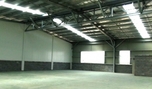
Total Area: 192m2
Occupancy Rate: 0%
Address: Thu Thua, Long An, Viet Nam
Total Area: 1000m2
Occupancy Rate: 0%
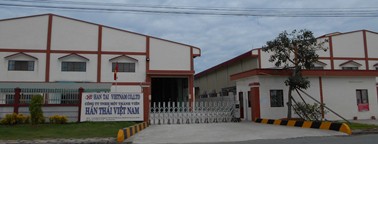
Address: Tan Lap Commune, Can Giuoc District, Long An Province.
Total Area: 524.14m2
Occupancy Rate: 0%
Address: Huu Thanh, Duc Haa, Long An, Viet Nam
Total Area: 303.31m2
Occupancy Rate: 0%
Address: Duc Hoa, Long An, Viet Nam
Total Area: 120m2
Occupancy Rate: 0%
Address: An Nhut Tan, Tan Tru, Long An
Total Area: 84m2
Occupancy Rate: 0%
Address: Can Duoc District, Long An Province.
Contact us
Type
Area
Location
Purpose
Contact us
Type
Area
Location
Purpose
Contact us
Type
Area
Location
Purpose
|
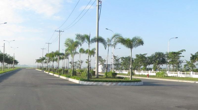
Transportation
Roads: Until May 2013, there were 5,825 km of road, including 217 km of Sai Gon – Trung Luong Highway and NR nos. 1, 50, 62, and N2. A 36-km section of NR no. 1, the important north – south communication, crosses Long An. It has been enlarged to 4 lanes with beltway and newlybuilt Tan An bridge. NR no. 50 linking HCMC with Tien Giang Province crosses two districts of Can Giuoc and Can Duoc by a length of 24 km. This road section has been badly damaged. NR no. 62 from Tan An City to Binh Hiep Border Gate (Moc Hoa District) has a length of 76 kms, fully asphalted except 2 km-section from Binh Hiep crossroad to the border gate. The provincial 23-km asphalted road no. 830 linking two districts of Ben Luc and Duc Hoa is the most important in terms of density of traffic communication. The other provincial roads are named by numbers of 821, 822, 8, 9, and 10. The rate of road surface in relation to natural area and population is respectively 0.34km/m2 and 0.99km/1,000 people, which is lower than the average of the Mekong Delta (respectively 0.71km/km2 and 1.62km/1,000 people). In the future, other roads such as Tan Son Nhat Airport – Tan An Highway, NR no. 1, Beltway no. 3 and roads linking seaports and border gates of the province will be built up to meet the need of interregional economic development. There are 942 bridges/32,601 m in Long An, comprising reinforced concrete bridges (627/23.156 m) steel bridges (193/6,419 m), suspension bridges (8/848 m), and wooden bridges (69/2,178 m). Waterways: In general, the waterway network is distributed relatively even, facilitating the people’s transport and travels. There is a waterway system of 8,912 km in length, linking Long An with the East Sea and rivers of Saigon, Dong Nai, Nha Be, and Cuu Long with a confluence of two main tributary of the Vam Co Dong River and the Vam Co Tay River through the Soai Rap estuary where a cluster of Port No. 5 is being built to serve export and import activities in the South. Main waterway routes are the rivers of Vam Co, Vam Co Dong, Vam Co Tay, Rach Cat. Important waterways such as HCMC – Ca Mau Province, HCMC – Tay Ninh Province, HCMC – Kien Luong cross Long An Province along Nuoc Man Canal, the Rach Cat River, and the Vam Co Dong River. Water transport means over 100 tons can navigate from the west to HCMC through canals of Phuoc Xuyen, Duong Van Duong, Tra Cu, Xang, Thu Thua and the rivers of Ben Luc and Rach Cat River. Total waterway length of 2,651 km has been demarcated for the following management levels: Central: 11 shipping routes; Provincial: 24 routes; District: 284 routes. Waterway communication density is 0,59 km/km2 and 1,90 km/1.000 people. |
|
|
Telecommunications
There are 424 post service sites of various levels, comprising 1 central post-office at Tan An City. Each site serves about 3,380 people living within an average radius of 1.8 kms. Daily mails and newspaper are delivered to all communes every day. There are 51 circuit-switch stations, 13 optical access equipments of V5.2 types and 9 subscriber sets. Total address capacity is 116,362 numbers, serving 105,600 subscribers with efficiency of 90.5 % and average service radius of one circuit-switch station is 5.3 km. The number of telephone set per 100 people is 27.3. The optical transmission network is of SHD technology with a total length of 382.6 km of optical cable. The peripherical network has 161,587 pairs of cables with a total length of 5,495 km. |
|
|
Water Supply
Total water supply capacity is about 50,000m3/day-night. The province is implementing three projects of water supply with a total capacity of 500,000m3/day-night. Water sources: two rivers of Vam Co Dong and Vam Co Tay are connected a by a complex network of waterways. This is the main water source of provincial people. However, the water quality is affected by salinity and alum. The people accessing clean water is 1,085,634, accounting for 77% of the provincial population. The water supply network comprises:
The underground water is not abundant and its quality is poor. Average depth of water availability is 200 meters. This source is exploited by some UNICEF drilling wells for about 50% of rural population. |
|
|
Electric Supply
There are two power transmission networks: (i) 220kV Phu Lam – Cai Lay and (ii) Cai Lay – Phu My. However, the province does not have a 220kV transformer station, thus, power supply depends mainly on three stations of Cai Lay, Nha Ba, and Phu Lam, with a total capacity of 2,000MW. The province has developed a power project of 600MW capacity in the period of 2007-2008. The power networks comprises the following transformers and generators:
|
| People's Council | No. 61, Nguyen Hue Street, Ward 1, Tan An Town, Long An Province. |
| People's Committee | 61 Nguyen Hue Street, Ward 1, Tan An City, Long An Province. |
| Relevant Government Departments |
|
| Province | Long An Province |
| Headquarter of People's Committee | 61 Nguyen Hue Street, Ward 1, Tan An City, Long An Province. |
| Official Provincial (or City) Website | www.longan.gov.vn |


