


Khanh Hoa Province

5197 km2

Southern Central Coast

2

17600

1,192,50 people (2013)
 Geography
 Economy
 Connection
 Infrastructure
 Government
 Social - Culture
| Total Area | 5197km2 |
| Agricultural Production Land | 927 km2 |
| Forestry Land | 2268 km2 |
| Specially Used Land | 841 km2 |
| Residential Land | 69 km2 |
|
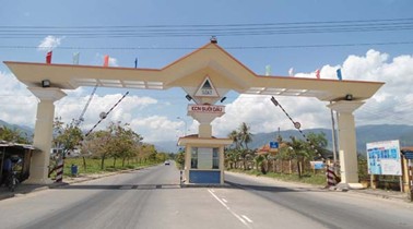
200 km and nearly 200 large and small islands. |
|
| Borders |
|
|
Climate
Khanh Hoa has relatively temperate climate, both tropical monsoon and oceanic features.
|
|
|
Natural Resources
Land: Khanh Hoa has 6 main following soil groups.
Oceanic resource: Khanh Hoa’s sea resource can be used to cash in the next period includes seaports, tourism, fishery catching and farming. Khanh Hoa coast is about 385km in length, 100km of which are white sand beach. There are peninsulars and wind-tight bays of Nha Trang, Van Phong, Cam Ranh, in which Nha Trang is one of the 29 most beautiful bays in the world, Cam Ranh is potential one for water way. In addition, Khanh Hoa has a large oceanic water space for big-size fishery farming. Aside from beautiful beaches, islands, Khanh Hoa holds an abundant oceanic species system in is ands of Hon Tre, Hon Tam, Hon Mun and Hon Thi... attracting lots of visitors. The natural advantages make it possible for Khanh Hoa to become one of the ten big and perspective tourist centers in the country. Khanh Hoa tourism becomes more and more diversified. It includes tours - mud and hot mineral water treatment for conditions, oceanic tours, forest tours, and tours of conferences and workshops... Fishery catches in Khanh Hoa waters approximate 150,000 tons annually, consisting mostly of upper surface feeders (70%). Permitted annual catch is about 70,000 tons. Besides fish, squids and mollusks, Khanh Hoa is also home to swallows yielding annually 2,000kg of saliva nests, a culinary delicacy Khanh Hoa sea water has high salinity therefore salt mining and processing of industrial salt are propitious. It is the precious speciality that other provinces barely hold. It not only contributes to products for export, but also is a precious raw material for high-grade drink processing. Khanh Hoa sea has a high salty concentration that is convenient to make common salt, after-salt products and industrial salt. Forestry resource: Current forest area, by statistics from Khanh Hoa Province, is 180,5 thousand ha; wood reserve is 18.5 million m3; 64.8% of the area are shrub forest and thin one; 34% of flood prevention forest are dense forests distributed on high mountains in districts of Khanh Vinh, Khanh Son, and Ninh Hoa. The rest are special use forest. Forest covers 38.5%; Khanh Vinh is covered with 65.4%, followed by Khanh Son 45.9%, the other districts are cov-ered with a less average rate, the least Nha Trang 10.8%, and Cam Ranh 11.8%. (to be continued) |
|
| GDP Growth Rate | 6.28% |
| Population | 1,192,50 people (2013) |
| Population Density | 231 person/km2 (2015) |
| Population By Sex | 97.2 males per 100 females (2015) |
7.50% (2015) |
|
| Immigration Rate | 1.60% (2015) |
| Labor Force At 15 Years Of Age And Above | 55.20% (2015) |
| Unemployment Rate | 4% |
|
Major Industries
Shipbuilding industry, seafood processing, construction materials, garments… |
|
| Annual Average Capital Of Enterprises | 86,035 billion dongs (2014) |
| Net Turnover | 106,772 billion dongs (2014) |
| Profit Before Taxes | 1,218 billion dongs (2014) |
| Profit Ratio | 1.11% (2014) |
| PCI | 58.69 (2015) - Rank: 27 |
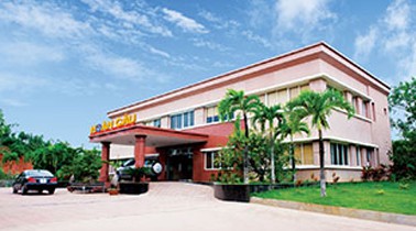
Total Area: 207.9m2
Occupancy Rate: 100%
Address: Ninh Hoa, Khanh Hoa, Vietnam
|
Transportation
Khanh Hoa transport network includes ways of road, rail, air, and water. The transport network is very convenient to trade and develop economy. Roadways: There are routes of national roads: National road No.1 that runs from northern to southern province, and links Khanh Hoa Province with northern and southern province, National road No.26 that links Khanh Hoa with Daklak, National road No. 27 that links Da Lat with Khanh Hoa. Furthermore, there are provincial roads. Nguyen Tat Thanh road links Cam Ranh Airport with Nha Trang City; Pham Van Dong road links Tran Phu road with National Road No.1; Khanh Binh – Ninh Xuan road links National Road No.26 with Khanh Vinh; a road leads to Hon Ba tourist area; a road leads to Dam Mon tourist area … They form a network of perfect transport to make full use of provincial potentials. Railways: Route of national railway runs across the whole length of the province. The route is about 149.2 km in length. It runs across Nha Trang City and all of the districts in the province. And there are 12 railway stations, of which a main station – Nha Trang one – is used to carry goods and passengers from Lam Dong, Buon Ma Thuot to northern and southern province. Airways: Cam Ranh Airport is located in the northern Cam Ranh peninsular, 30km away from Nha Trang City, and has come into operation since 2004. It is being invested and built to become an international airport by a decision from the government. Waterways: A 370 – km coast is very convenient to build sea ports. Khanh Hoa sea port system consists of:
|
|
|
Telecommunications
Use of modern technology electronic switch boards, most districts avail digital boards. Telephone networks cover 100% of villages.GSM mobile phones, Internet are being widely used in Nha Trang City and every district of the province. |
|
|
Electric Supply
Khanh Hoa use electronic switching systems of modern technology, the switchboard number of districts have 100% coverage communal landline, mobile and Internet networks. 103/105 communes province had postal service points - telecom, accounting for 98%. |
| People's Council | 1 Tran Phu Street, Nha Trang City, Khanh Hoa Province. |
| People's Committee | 1 Tran Phu Street, Nha Trang City, Khanh Hoa Province. |
| Relevant Government Departments |
|
| Province | Khanh Hoa Province |
| Headquarter of People's Committee | A1, Complex base 1 Tran Phu Street, Nha Trang City, Khanh Hoa Province. |
| Official Provincial (or City) Website | www.khanhhoa.gov.vn |


