


Son La Province

14174.4 km2

Northern Highland

2

4624

1,195,107 people (2013)
 Geography
 Economy
 Connection
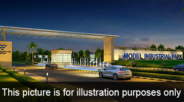
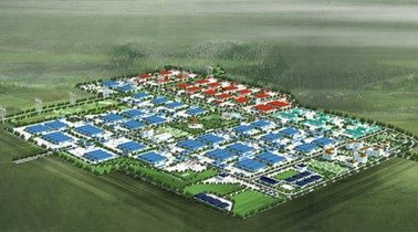
 Infrastructure
 Government
 Social - Culture
| Total Area | 14174.4km2 |
| Agricultural Production Land | 2865 km2 |
| Forestry Land | 6280 km2 |
| Specially Used Land | 198 km2 |
| Residential Land | 74 km2 |
| Borders |
North: Yen Bai, Lao Cai. East: Hoa Binh and Phu Tho. West: Lai Chau, Dien Bien. Southern: Thanh Hoa. |
|
Climate
Son La, whose climate is subtemperate, has two seasons: the dry and the wet. The average annual temperature is 21.40C, with highs peaking at 270C and lows being 160C. Annual rainfall averages 1,200- 1,600 mm and average humidity is 81%. The number of days with the dry west wind in a year increased to 4.3 in Son La Town and 37.2 in Yen Chau. However, the climate in the plateaus of Moc Chau and Na San is cool, fresh, and advantageous to the development of agriculture and tourism. |
|
|
Natural Resources
Mineral: Son La has more than 50 mineral mines and pits, many of which are precious mines such as nickel, copper in the Phuc - Muong Khoa mountainous village (Bac Yen); talcum in Ta Phu mountainous village (Moc Chau district); manherit in Phung mountainous village (Mã river); coal inSuối Bàng commune (Moc Chau district) and Quynh Nhai district and other precious minerals such as gold, mercury, iron that can be exploited to develope the mining industry in the near future. Especially with sources of limestone, clay, kaolin with large reserve and good quality,the province has potential to develop industries of construction materials such as cement, high quality sand, construction stone, adobe brick, paving stones. Forest resource: Son La has many kind of plants and animals which are very abundant and diverse. Son La Forests have many genetic resources of precious species and special used forests which are valuable for scientific research such as Sop Cop, Xuan Nha (Moc Chau), Ta Xua (Bac Yen), Co Pia (Thuan Chau). Water resourse: Surface water resources of Son La province is about 19 billion m3, mainly from rainwater stored in two main river systems, namely Da River and Ma River.
Land resource: The natural area of Son La province is the 5th biggest among 64 provinces in the country. The land being in use accounts for 39.08%. Fertile soil with thick layers and various types of soil allow the province to develope variety of plants and animals which produce high economic value. The unused land and area of streams, rivers accounts for 60.92%. Land fund for development of long-term industrial crops such as coffee, tea, fruit trees is 23,520 ha, for pasture to grow livestock is 1,167 ha. |
|
| GDP Growth Rate | 11.28% (2014) |
| Population | 1,195,107 people (2013) |
| Population Density | 83 person/km2 (2015) |
| Population By Sex | 101.3 males per 100 females |
17.30% (2015) |
|
| Immigration Rate | 0.60% (2015) |
| Labor Force | 17,896 people (2014) |
| Labor Force At 15 Years Of Age And Above | 63.20% (2015) |
| Unemployment Rate | 4.15% |
|
Major Industries
And hydroelectric power industry, agricultural products processing, feed processing, production of construction materials, mining and deep processing of minerals, garments, footwear, increasing the proportion of goods export industry of deep processing |
|
| Annual Average Capital Of Enterprises | 30,061 billion dongs (2014) |
| Net Turnover | 18,673 billion dongs (2014) |
| Profit Before Taxes | 400 billion dongs (2014) |
| Profit Ratio | 2.12% (2014) |
| PCI | 57.21 (2015) - Rank: 44 |
|
Transportation
Roadway: The roadway system on the whole province is 9,529 km in length, including:
Inland waterway: The riverway system is 486 km in length:
|
|
|
Telecommunications
Telecommunications network has been upgraded and expanded. At present the mobile phone network covers the whole province, making it very convenient for domestic and international telecommunication by means of telephone orelectronic message. Broadcasting system is gradually modernized. The whole province has 42 TV stations. |
|
|
Water Supply
There is a water treatment plant in Son La city with capacity of 12,000 m3/day&night; Mai Sơn District water plant with capacity of 4,800 m3/day&night, and a water supply system for towns, residential areas and communes. Currently, a wastewater treatment project in Son La city, a water treatment plant and a waste water treatment project in Moc Chau urban area are under development. |
|
|
Electric Supply
Son La city and 11/11 districts (204 wards and communes) of Son La province have had access to the national grid system. Son La hydropower project with the largest scale in Southeast Asia is a new opportunity for Son La to outgrow. After completion,this project will create new potential for Son La to intergrate with the economy of the whole country. |
| People's Committee | To Hieu Ward, Son La City, Son La Province. |
| Relevant Government Departments |
|
| Province | Son La Province |
| Headquarter of People's Committee | Hoang Quoc Viet Street, Chieng Coi Ward, Son La City, Son La Province |
| Official Provincial (or City) Website | www.sonla.gov.vn |


