


Phu Yen Province

5060 km2

Southern Central Coast

3

5229

883,200 people (2013)
 Geography
 Economy
 Connection
 Infrastructure
 Government
 Social - Culture
| Total Area | 5060km2 |
| Agricultural Production Land | 1362 km2 |
| Forestry Land | 2539 km2 |
| Specially Used Land | 258 km2 |
| Residential Land | 57 km2 |
|
189 km |
|
| Borders |
North: Binh Dinh province. West: Gia Lai city. South: Khanh Hoa, Dak Lak. East China Sea. |
|
Climate
Tropical monsoon with oceanic climate influence. Average annual temperature is 26.5 C, annual average precipitation, 1,500 – 3,000mm, average annual luminosity 2,450 hours, average relative humidity, above 80%. |
|
|
Natural Resources
Forests: Forest land covers 36.4% of the total land space; natural forests occupy 156,000ha and hold 16 million m3 of timber reserve. There is also a natural reserve, Krong Trai, spreading over 14,000ha, Ca Pass forest scape, 9,000ha. Forest flora and fauna are rich and biodiverse. Besides potential for paper pulp production, cattle raising, forests can also serve as ecological sites attracting tourists and scientific research. Soil resources: The province has high potential for varying purposes land utilization: Van Hoa, An Xuyen highland areas with red basaltic soil, fresh weather conditions, lend themselves to industrial and fruit crops planting. Phu Yen has been long considered a rice bowl of Central Vietnam. Tuy Hoa plain, 500km2 large, is conducive to sustainable agricultural development. Water resources:
Marine resources: Efficiently exploitable sea expanse is in the range of 6,900km2, the fishing ground provides high economic value marine animals: prawns, squids,fish… The coast line is 189km long, dotted with ponds, pretty bays conducive to catching, raising marine life and eco-marine tourist development. Mineral resources: Highly diverse, some have sizeable deposits industrially exploitable: diatomite (90 million m3) granite (54 million m3) gold ore, fluorite (300,000tons). Propitiously, these minerals form dense, quality aggregates for easy exploitation and transportation. Moreover there are health promoting hot mineral water springs at Phu Sen (Phu Hoa District), Triem Duc, Tra On (Dong Xuyen District), Lac Sanh (Tay Hoa District). |
|
| GDP Growth Rate | 12% (2014) |
| Population | 883,200 people (2013) |
| Population Density | 177 person/km2 (2015) |
| Population By Sex | 100.1 males per 100 females |
7.40% (2015) |
|
| Immigration Rate | 1.40% (2015) |
| Labor Force | 887,374 people (2015) |
| Labor Force At 15 Years Of Age And Above | 59.40% (2015) |
| Unemployment Rate | 4% |
|
Major Industries
Electronics, petroleum refining, petrochemical, shipbuilding, agricultural and aquatic products processing, production of electricity - water. |
|
| Annual Average Capital Of Enterprises | 24,899 billion dongs (2014) |
| Net Turnover | 33,353 billion dongs (2014) |
| Profit Before Taxes | 79 billion dongs (2014) |
| Profit Ratio | 0.23% (2014) |
| PCI | 56.15 (2015) - Rank: 55 |

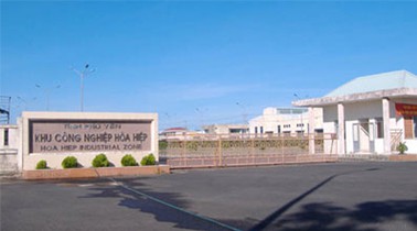
Total Area: 221m2
Occupancy Rate: 0%
Address: Dong Hoa, Phu Yen, Viet Nam
Total Area: 101.5m2
Occupancy Rate: 0%
Address: Dong Hoa, Phu Yen, Viet Nam
|
Transportation
Landways: National Road 1A cuts through Phu Yen on the north – south axis over a 117.5km length, National Road 1D winding along the coast line links Song Cau District (Phu Yen) with Quy Nhon City (Binh Dinh); National Road 25 and inter-provincial road DT 645 running along the East - West axis, joins Phu Yen with the West Highland provinces, whereby connection can be made with the Trans-Asia Highway crossing Indochina peninsula countries. Inter-provincial and inter-district roads are being upgraded. The National Road 1A beltway by-passing Tuy Hoa, Phu Lam townships, going through the new 1,500m long Da Rang Bridge, is in construction. In the near future a tunnel cutting across Ca Na will be built. Railways: The Trans-Viet Railway rolling on the North -South axis, transits in Phu Yen at Tuy Hoa main station at 1,197km distance mark and other stations such as La Hai, Chi Thanh, An My, Dong Tac, Phu Hiep, Hao Son. Airways: Tuy Hoa Airport, 7km south of Tuy Hoa City, which is rated as one of the major airports in Central Vietnam with a 3km long landing strip, nonturbulent air space, safe for landing heavy crafts. Tuy Hoa – Ho Chi Minh weekly flights are operational. In future, new flight routes Tuy Hoa – Hanoi, Tuy Hoa – Danang will open; potential investments open for upgrading Tuy Hoa Airport into an international airport serving socio-economic development of Southern Central Vietnam. Waterways: Phu Yen avails ponds and bays propitious to in-and-out ship movement, shelter and docking. Particularly Vung Ro Bay which can accommodate 5,000 –ton ships, is being built into a large scale commercial sea port. Transportation facilities are quite abundant with bus stations, private cars parts, high quality vehicles and taxicabs fulfilling traveler needs. Fast developing systems: all villages have post service cum cultural center, 100% villages have telephones, telephone density has grown from 8.8/100 inhabitants to 12/100 inhabitants, mobile phone coverage reach 80% of local territory. |
|
|
Telecommunications
Phu Yen has good telecommunications network. Provincial Postal Service centers, districts and communes equipped: Microwave, fiber... to ensure smooth communication. Total number of post offices, agents and kiosks across the province is 133 units, the total number of telephone 14 716 machines; postal services also thrived. |
| People's Council | No. 01 Independence Street, Tuy Hoa City, Phu Yen Province. |
| People's Committee | No. 07 Independence Street, Tuy Hoa City, Phu Yen Province. |
| Relevant Government Departments |
|
| Province | Phu Yen Province |
| Headquarter of People's Committee | No. 07 Independence Street, Tuy Hoa City, Phu Yen Province. |
| Official Provincial (or City) Website | www.phuyen.gov.vn |


