


An Giang Province

3536.7 km2

Mekong River Delta

4

6164

2,155,300 people (2014)
 Geography
 Economy
 Connection
 Infrastructure
 Government
 Social - Culture
| Total Area | 3536.7km2 |
| Agricultural Production Land | 2788 km2 |
| Forestry Land | 139 km2 |
| Specially Used Land | 271 km2 |
| Residential Land | 153 km2 |
| Borders |
The east and north by nearly 107.628 km² Dong Thap ranked 4th in the Mekong Delta province of Kien Giang area following, Ca Mau and Long An province, north west of Cambodia near the long border with 100 km, south and southwest borders Kien Giang province approximately 69.789 kilometers to the southeast, bordering the city of Can Tho. |
|
Climate
There are two distinct seasons: the raining season is from May to November and the dry season from December to April next year. The annual average temperature is about 27°C. The highest temperature is 35°C- 37°C from April to May and the lowest is 20°C- 21°C from December to January the following year. In general, the climate conditions are favorable for agricultural development. An Giang is affected by 2 winds: the southwest monsoon and the northeast monsoon. The former is cool and humid, creating the raining season, the latter creates hot and dry weather.
In addition, there are also weather phenomena of tornados, hails, droughts, and effects of Elnino và Lanina. |
|
|
Natural Resources
Land resources: An Giang has 37 different kinds of land, forming 6 main groups of land, in which the group of alluvial land takes the most part–151,000 ha (making up 44.5% of the natural land) that is very favorable for crop plants; alum alluvium land is over 93,800 ha (making up 27.5% of the natural land); the group of local developed and ancient alluvium land is nearly 24,724 ha (making up 7.3% of the natural land); the remaining is alum land and others. Forest resources: An Giang has over 583 ha of natural tropical forest, most of which is large leaf canopy trees with 154 kinds of valuable and rare trees belonging to 54 families. Besides, there are 3,800 ha of indigo forest. The forest area has been rapidly reduced after a time. The provincial authorities have paid much attention on afforestation recently. The fauna of An Giang is also rich with several valuable and rare species. Aquatic products resources: An Giang has two big rivers of Tien and Hau that belong to Mekong River system. Together with the system of canals, ponds and lakes, these are huge aquatic product resources that are favorable for the development of fish breeding in floating houses and ponds, and aquaculture in fields. Mineral resources: An Giang has more mineral resource than other provinces of the Mekong River Delta such as granite, sandstone, tile clay, kaolin, peat, shells, puzzoland, feldspars, bentonite, sand, gravel, etc. that meet the requirement for construction material for the region. However, the province must pay attention on the balance between exploitation and the protection of the ecology and environment. |
|
| GDP Growth Rate | 6.5% |
| Population | 2,155,300 people (2014) |
| Population Density | 610 person/km2 (2015) |
| Population By Sex | 98.1 males per 100 females (2015) |
4.90% (2015) |
|
| Immigration Rate | 2.10% (2015) |
| Labor Force | 1,350 people (2014) |
| Labor Force At 15 Years Of Age And Above | 55.3% (2015) |
|
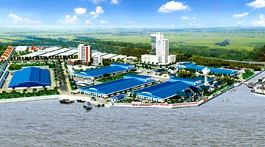
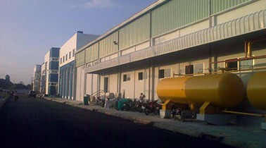
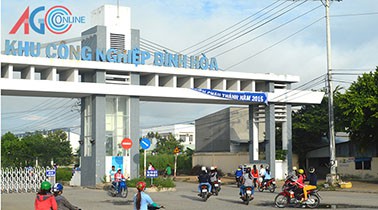
Major Industries
Industrial and handicraft. Incentive industries:
|
|
| Annual Average Capital Of Enterprises | 61,843 billion dongs (2014) |
| Net Turnover | 82,843 billion dongs (2014) |
| Profit Before Taxes | 2,305 billion dongs (2014) |
| Profit Ratio | 2.76% (2014) |
| PCI | 57.61 (2015) - Rank: 39 |
Total Area: 100m2
Occupancy Rate: 0%
Address: Hoi An, Cho Moi, An Giang
Total Area: 120m2
Occupancy Rate: 0%
Address: Chau Phu District, An Giang Province.
Total Area: 131.8m2
Occupancy Rate: 0%
Address: Chau Thanh District, An Giang Province.
|
Transportation
Road and bridge:
Railways: Can Tho–An Giang–Viet Nam–Cambodia border. Waterways: Tien River (section through An Giang: 87 km) and Hau River (100 km) are two important rivers linking the province with Cambodia, Laos and Thailand. In addition, a network of channels level 2, 3 ensures activities of waterway transport with the scale of 50-100 tons.
Airways: An Giang Airport will be built in Chau Thanh District. |
|
|
Telecommunications
An Giang is striving to reach the moderately good level of information technological and telecommunications development in comparison to the whole country by 2020. |
| People's Council | 01 Ton Duc Thang Street, My Binh Ward, Long Xuyen City, An Giang. |
| People's Committee | 82 Ton Duc Thang Street, My Binh Ward, Long Xuyen City, An Giang. |
| Relevant Government Departments |
|
| Province | An Giang Province |
| Headquarter of People's Committee | 82 Ton Duc Thang Street, My Binh Ward, Long Xuyen City, An Giang. |
| Official Provincial (or City) Website | http://www.angiang.gov.vn |


