


Dong Nai Province

5907.2 km2

Southeast

33

35606

2,872,720 people (2015)

2
 Geography
 Economy
 Connection
 Infrastructure
 Government
 Social - Culture
| Total Area | 5907.2km2 |
| Agricultural Production Land | 2762 km2 |
| Forestry Land | 1814 km2 |
| Specially Used Land | 507 km2 |
| Residential Land | 170 km2 |
| Borders |
Binh Thuan province in the East. With the provinces of Ba Ria - Vung Tau and Ho Chi Minh City. North of Lam Dong and Binh Duong. |
|
Climate
Dong Nai lies in the monsoon tropical zone and is affected by the north-east and south-west monsoon. It is also put under the influence of Pacific Ocean tropic atmosphere between April and October. There are two distinct seasons: the rainy season lasts from March or April to November and the dry season from December to March or April of the following year. Average temperature goes between 23.9 – 29oC, much lower than standard level of the tropical regions (26-30oC). Its rainfall is quite high with 1,500 mm – 2,700 mm. On average, the weather is sunny for 4-9.5 hours a day and does not exceed 11.5 hours per day, even on the hottest and sunniest days. Total rainy days within a year are between 120 - 170 days (standard level of tropical region is 150 - 160 days) with total rainfall of some 1,500 - 2,750 mm. The average humidity is around 80 - 82% and humidity in the dry season is 10 - 12% lower than that of the rainy season. The humidity is inconsiderably different among the areas. Dong Nai Province's weather with regular sunshine, rain and high humidity equally found in the |
|
|
Natural Resources
Land resources: Dong Nai is the province which possesses the largest area of agricultural land in the eastern region of South Viet Nam. There are 5 main groups of soils classified by FAO/UNESCO. Cultivation land is mostly composed of basalt soil suitable for development of for industrial plants and fruit trees. Water resources: Dong Nai has a relatively abundant surface water with average density of 0,5 – 1,2 km of river/km2, but unevenly distributed. Most of rivers and springs are concentrated in the northern region and along the Dong Nai River in the south-western region. There are 2 main rivers, i.e. Dong Nai, 220 km and La Nga, 70 km, providing water for utilization and waterways. Other large rivers are La Buong, Thi Vai, Ray, and Dinh. Total water volume is 25.8 billion m3 a year, varying from 85-90% to 10-15% in the respectively rainy and dry season. The underground water for industrial purpose is not abundant, concentrating in the south of Long Thanh district and the north of Bien Hoa City. There are 5 sites having mineral water, including Suoi Nho where the reserve may reach 10,000m3/day. Mineral resources:
Forestry resources: Dong Nai abounds in forest with 153,586 ha, accounting for 30% of the provincial area. It has a diversified ecology with 614 species of plants and 250 species of animal. This a favorable condition for development of ecological environment, tourism, and exploitation of forest products. Forests have basic characteristics of tropical forests with a varied fauna and flora, as represented by Nam Cat Tien National Park, a natural reserve region rich in rare and precious animal and vegetal species with the implementation of the present program for forest cultivation (including the cultivation of perennial industrial trees). In 1976 forests covered 47.8% of the provincial natural area, decreasing to 21.05% in 1981. |
|
| GDP Growth Rate | 11.55% (2014) |
| Population | 2,872,720 people (2015) |
| Population Density | 492 person/km2 (2015) |
| Population By Sex | 94.5 males per 100 females (2015) |
12.10% (2015) |
|
| Immigration Rate | 20.40% (2015) |
| Labor Force At 15 Years Of Age And Above | 54.70% (2015) |
| Unemployment Rate | 2.5% (2015) |
Major Industries
|
|
| Annual Average Capital Of Enterprises | 540,541 billion dongs (2014) |
| Net Turnover | 761,337 billion dongs (2014) |
| Profit Before Taxes | 37,016 billion dongs (2014) |
| Profit Ratio | 4.68% (2014) |
| PCI | 57.79 (2015) - Rank: 37 |
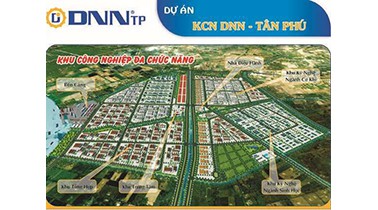
Total Area: 262m2
Occupancy Rate: 0%
Address: Tan Phu Industrial Park, Tan Phu Town, Tan Phu District, Viet Nam
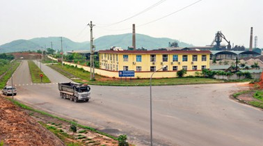
Total Area: 39.17m2
Occupancy Rate: 0%
Address: Long Thanh, Dong Nai

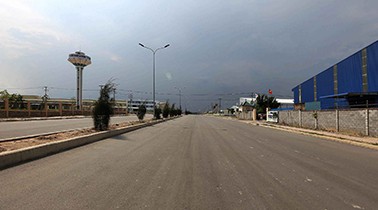
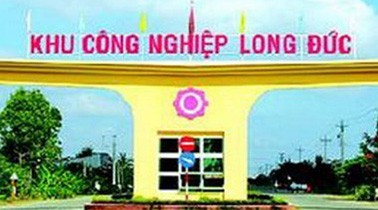
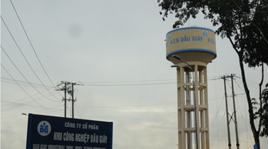
Total Area: 270m2
Occupancy Rate: 0%
Address: Long Duc commune, Long Thanh district, Dong Nai Province
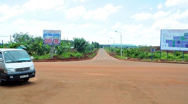
Total Area: 149.5m2
Occupancy Rate: 0%
Address: Suoi Tre, Long Khanh, Dong Nai
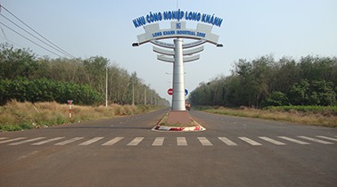
Total Area: 264.47m2
Occupancy Rate: 0.1366%
Address: Long Khanh, Dong Nai

20 - 25 million/ m²
Type
Area
Location
Purpose

70 USD/m2/38 year
Type
Area
Location
Purpose
|
Transportation
Roads: Dong Nai Province has an advanced traffic system with many backbone national roads, such as: National Road (NR) nos 1A, 20, 51, North–South railway lines; Located adjacent to the Saigon Port and Tan Son Nhat International Airport, Saigon port cluster in HCMC and Cai Mep – Thi Vai port cluster in Ba Ria – Vung Tau Province. Such site offers many advantages to economic activities in the area. Its location is very important for the development of the Southern economic main hub and a junction of the South Eastern and the Central Highlands. Railways: The North – South Railway runs through Dong Nai with a total length of 87.5 km and 8 platforms at Bien Hoa, Ho Nai, Trang Bom, Dau Giay, Long Khanh, Bao Chanh, Gia Ray, and Trang Tao. The railway still plays an important role in the passenger and freight transport. Bien Hoa platform is the major terminal, equipped with “semi-automated train operation system”. Waterways: Dong Nai s a landlocked province. The inland waterway includes more than 532 km, of which 205 km are navigable water. The commercially important waterways comprise 8 rivers of Dong Nai, Thi Vai, Dong Tranh, Cai, Nha Be, Long Tau, Go Gia, and La Nga, of which the former, 162 km in length, is the most critical waterway for cargo transport in Dong Nai Province and from here to HCMC, 2 provinces of Ba Ria – Vung Tau and Binh Duong. Other lines belonging to the Dong Nai River are the Nha Be River, 8.5 km in length, and the Long Tau River, 9 km in length, have passages for ocenn liners to acccess ports of Sai Gon, Cat Lai in HCMC and Phu Huu, Ong Keo in Dong Nai Province. The Thi Vai River has passage for ocean liners to access port areas of Go Dau and Phuoc An. Airways: The 40-km2 Bien Hoa Airport is under the Ministry of Defence’s management. The Government will build Long Thanh Airport to receive about 100 million passengers a year. |
|
|
Telecommunications
The provincial network of telephone and telecommunication has connected with those of Vietnam and other countries, including ADSL, data transmission (DDN, xDSL, Frame relay, Leased line), Video Conference. The express delivery system has been implemented by Fedex, DHL, EMS, and CPN, etc. The average number of telephone and internet subscriber over 100 population in 2010 is respective 121 and 20.5 |
|
|
Water Supply
Total water supply output in 2010 is 320.000m3/day. It is expected to reach 550.000m3/day in 2015, sufficient to provide water to urban areas and industrial parks. |
|
|
Electric Supply
The province uses the national power grid, comprising voltage leves of 110kV, 35kV, 22kV, 15kV with a total transmission line of nearly 6,000 km. Total electricity output of Dong Nai in 2010 is 6.1 MW. The distribution network of high voltage 110/220 KV with 2,400KVA transformers, medium voltage 15/22 KV with 2,500KVA transformers has covered 171 communes and wards of the province. |
| People's Council | 2 Nguyen Van Tri Street, Bien Hoa City, Dong Nai Province. |
| People's Committee | 2 Nguyen Van Tri Street, Thanh Binh Ward, Bien Hoa City, Dong Nai Province. |
| Relevant Government Departments |
|
| Province | Dong Nai Province |
| Headquarter of People's Committee | 2 Nguyen Van Tri Street, Thanh Binh Ward, Bien Hoa City, Dong Nai Province. |
| Official Provincial (or City) Website | www.dongnai.gov.vn |


